Miscellaneous Places
Here we see a few old buildings or places which don't fit neatly into one of the eight main pages.
Multiview Postcards


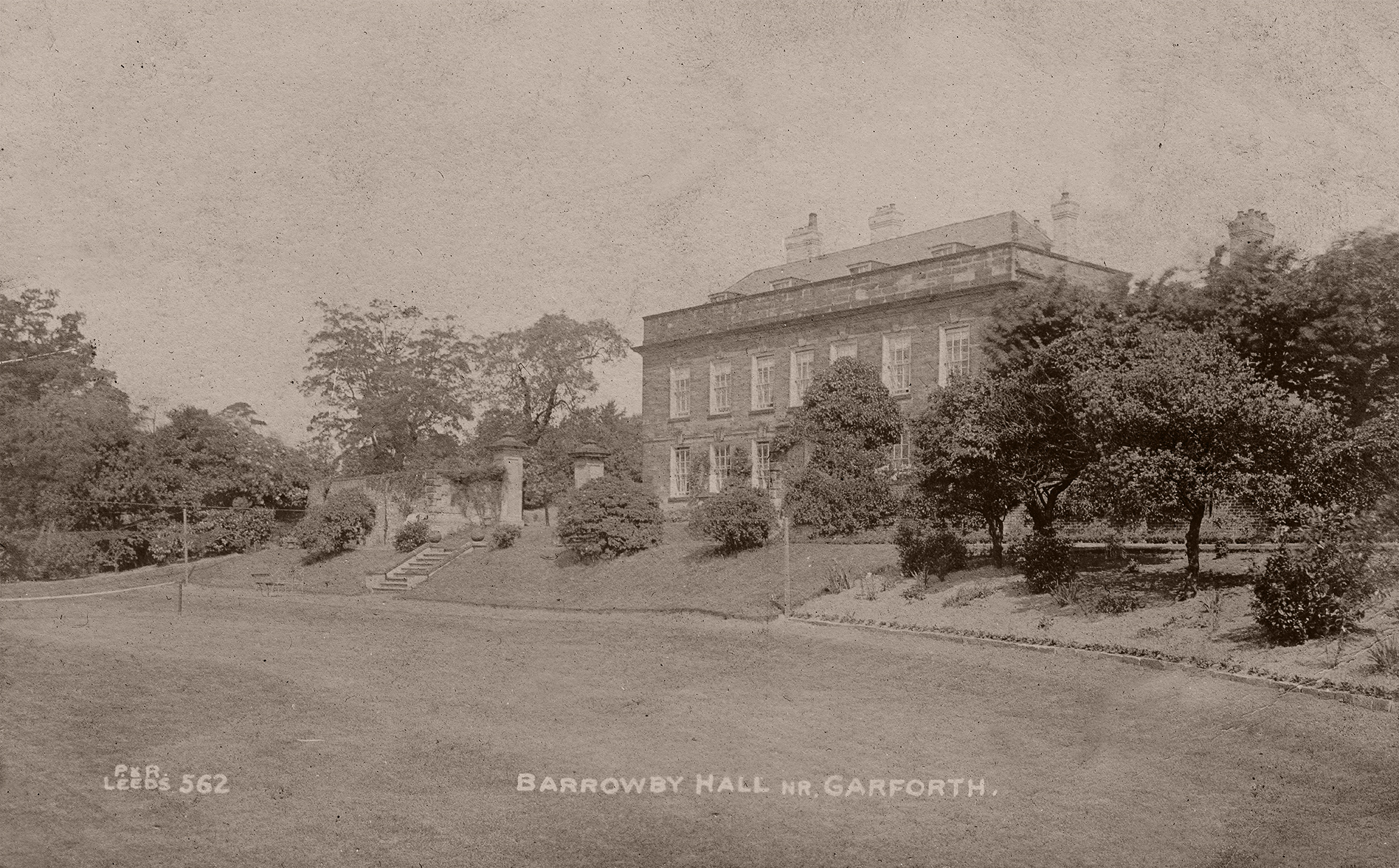
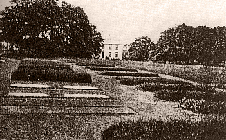
Barrowby Hall
Barrowby Hall is a country house on Barrowby Lane to the West of Garforth which still exists today.
The hall is a grade II listed building originally built in 1677 and remodelled in 1720.
When I was younger it used to be possible to walk or ride a bike along the path in front of the hall towards Austhorpe but these days the road is gated and marked private at both ends so sadly you can't get up close to the building any more.

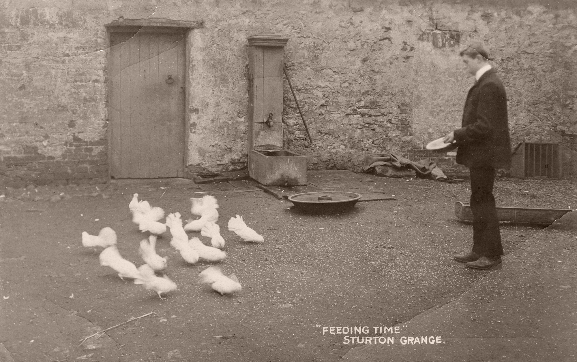
Sturton Grange
Sturton Grange still exists today by name and is the location of the Makins fruit farm on the top of Garforth Cliff which is now all modern buildings.
As can be seen on some of the old maps there used to be some woods and a moat there so I expect it was quite a nice farm originally.


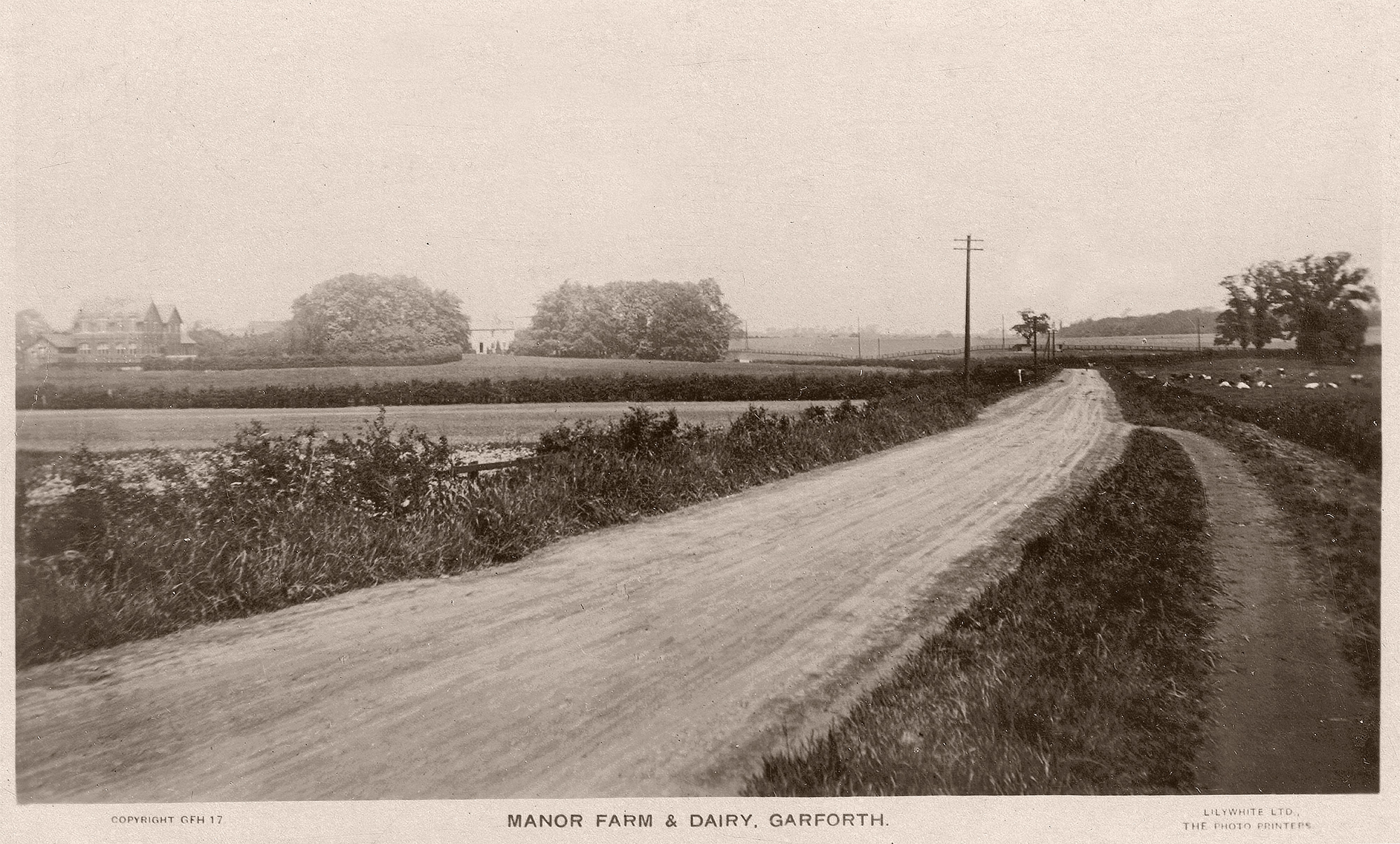
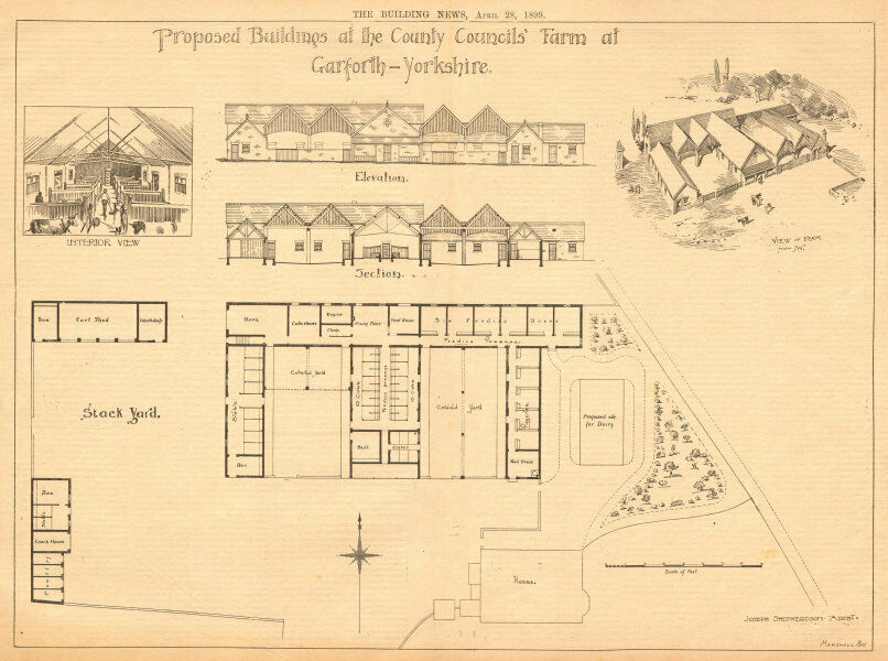
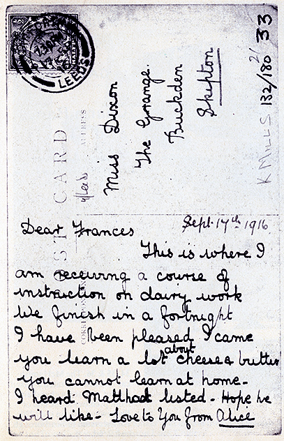
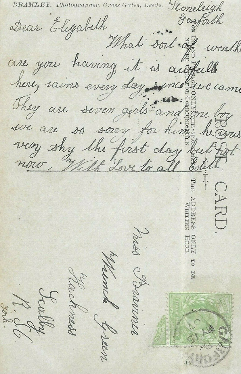
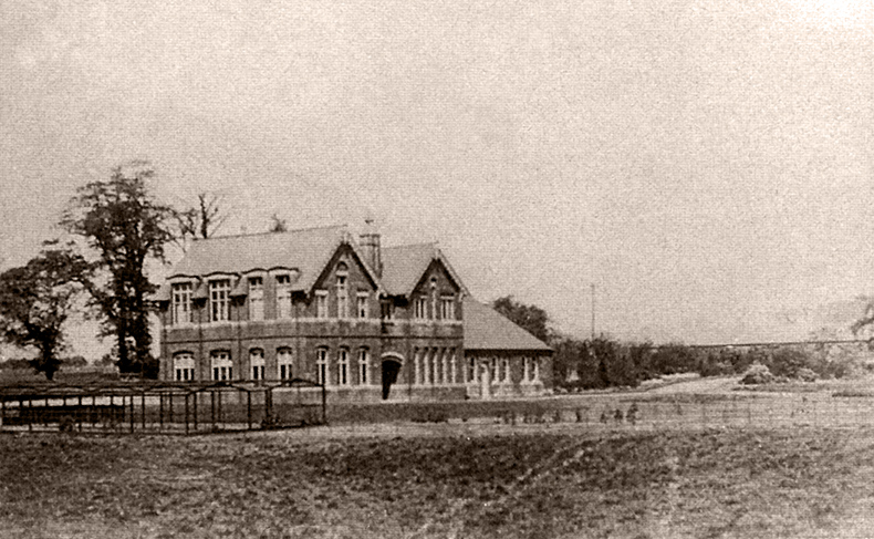
Manor Farm
Manor Farm was owned by the University of Leeds and was used for dairy and agricultural experiments. It was leased in 1898 and finally closed down in 1928 when it was replaced by Askham Bryan near York, but was not demolished until 1978 [2][3].
Although it would seem an odd subject for a postcard by today's standards for some reason there seem to have been lots available at the time!
awaiting new photo
- date
- Unknown
- copyright
- Unknown
- full size
- 793x475px
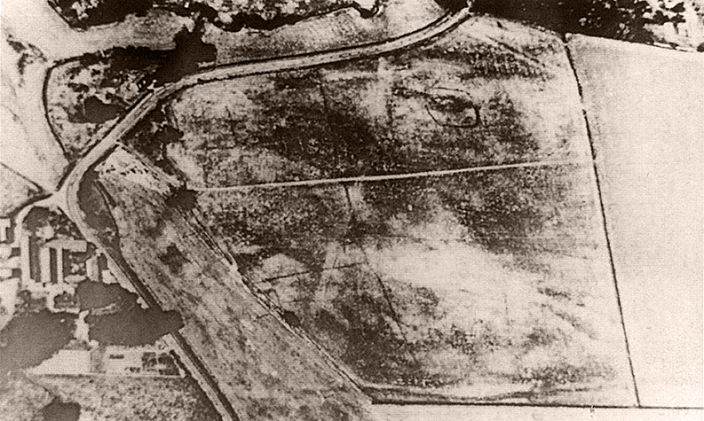
An aerial photograph showing the position of Manor Farm in Barwick Road. As you can see in the modern image new buildings stand there now with the same name.
- date
- c.1934
- copyright
- Lilywhite
- full size
- 2000x1206px
- postcard
- Lilywhite GFH17
Looking towards Barwick down Barrowby Road with the farm away to the left.
Exterior


Interior


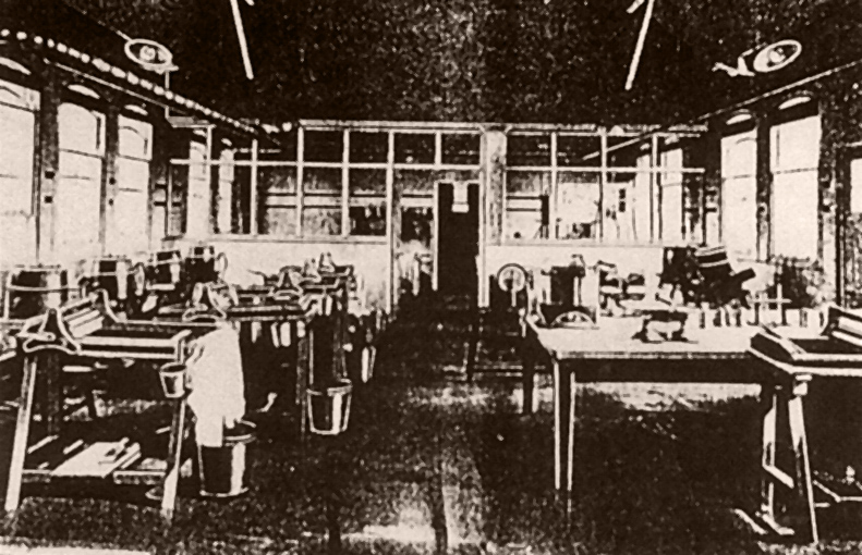
Events

- date
- 1920s?
- copyright
- Bramley
- full size
- 2000x1260px
- postcard
- Bramley B02-ALT1
People dressed up for a carnival.
Unknown Locations
- date
- 17th Feb 1898
- copyright
- Unknown
- full size
- 2000x1362px
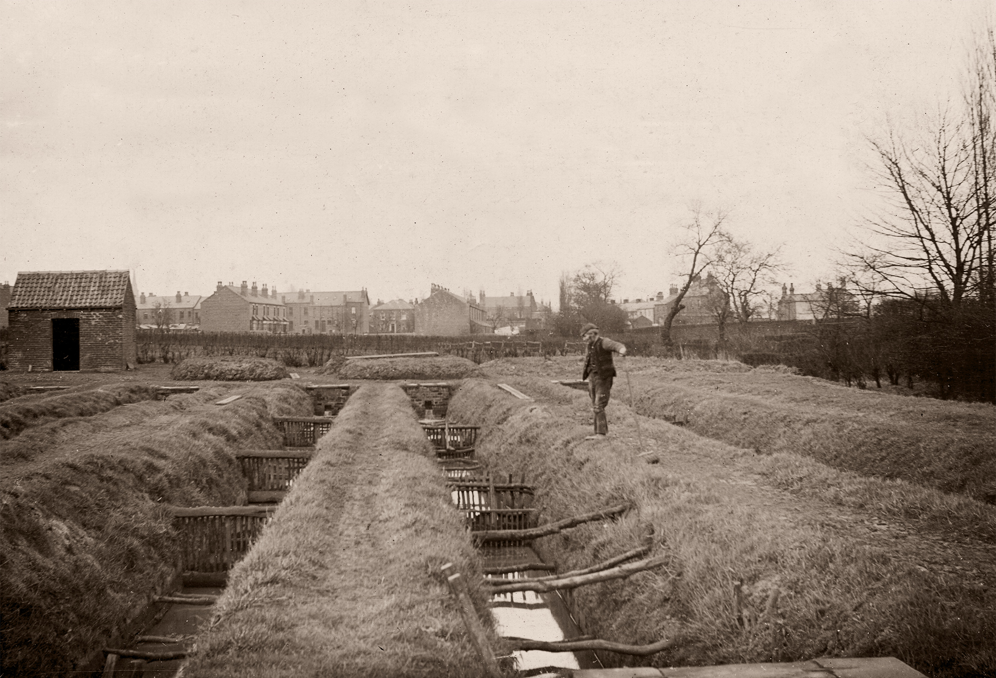
This image is marked 'Tadcaster rural, Garforth, peat trenches, 17.2.98' in pencil on the reverse. It was in a set with another photo of a sewage outlet which makes me think they were some kind of survey photos being done by the council of the time.
I am struggling to work out the exact location of the picture though, the church spire can be seen faintly to the right of the brick shed which makes me think this was possibly somewhere around Barleyhill playing fields or the bottom of Lyndon Avenue?
I can't think where else the type of housing would have been at the time which can be seen other than on Barleyhill Road.